
Recommended Posts
Farflung 0

Yep it’s a new dawn with thread participants still using the ‘University of Hold my Beer and Watch This’ phrase of ‘known facts’ with a sense of academic achievement. What exactly would an unknown fact be? There is some money being made at a website called ‘Engrish’ where our primary language is butchered to such a degree that the message is completely lost in the translation. I can almost understand this condition since these people speak Japanese, Chinese or Arabic as their primary language. What exactly is an American’s excuse?
I thought I would harvest the rich bounty from this thread and create a new meme called ‘Amerrhea’ which is a corruption and contraction of American, err and diarrhea….. Amerrhea. Those oft used phrased which have slipped blissfully into the Yankee lexicon and exist as a sort of linguistic freak show for the rest of the world to ponder. Fragments like ‘Exact Change’, ‘Watch Your Head’ and ‘Stupid Idiot’ come to mind a part of the cornucopia of this mono linguistic babble.
In association and parallel development with the ‘Candwich’ which is a sandwich in a can I have created another Amerrhea entry called the ‘Sodag’ which is a soda in a sandwich bag. Thus insuring that the good Earth remain in perfect balance. You’re welcome.

Farflung, I feel your pain...
Do you mean "sitting witness"...?
I'm not siting...I mean citing...all my qualifications...but will admit to being a high school dropout...I will also admit to having a paper from the gubberment that indeed proves I've had an original idea...but WTF is "siting"...?
I'm easily confused with Anglish so would someone please explane what a "siting" is so I can get up to speed on this Cooper thing.
"Mans got to know his limitations"
Harry Callahan
QuoteNO one ever expected me to find actual siting witnesses that are still alive.
Do you mean "sitting witness"...?
QuoteThere were sitings of that plane below 10K.
Quote
The siting in the Heisson area definitely were low - 5K to 6K.
Quote
Sitings in Hiesson also claim the plane was lower.
I'm not siting...I mean citing...all my qualifications...but will admit to being a high school dropout...I will also admit to having a paper from the gubberment that indeed proves I've had an original idea...but WTF is "siting"...?
I'm easily confused with Anglish so would someone please explane what a "siting" is so I can get up to speed on this Cooper thing.
"Mans got to know his limitations"
Harry Callahan
Robert99 37

Note to Robert 99
There were sitings of that plane below 10K. I live between several bases - and I have been shown by pilots - just how high the planes are that pass over. North and East of the Lewis - the plane did drop in altitude and continued to do so until they approached East of the PDX swinging over toward Cames - they were trying to stay out of populated areas and they had to be clear of the PDX air traffic. ,,which took them right over Troudale Industrial and the airstrip there. (Don't forget the sitings in that area). Maybe it was other aircraft going in and out of PDX...but the 727 had to say above then and out of the way.
The siting in the Heisson area definitely were low - 5K to 6K. The clouds where there, but the plane sounded like a plane in trouble it was so low. - thru the layers of clouds they they could see lights above. I told the man the plane was probably higher because the layered cloud coverage - might give one the allusion of the plane being lower.
He wouldn't bite on that and said swore it was NOT over 5K (sound and lights) - this is North East of Battleground.
Sitings in Hiesson also claim the plane was lower. The sound was NOT that of the chase planes like Himmelsbach tried to tell one of the witnesses - she knew the sound of the small fast crafts versus a 727. I know the difference in the sound coming thru my area. 5 bases and 2 airports not counting all of the small private strips.
Jo, Sorry to disappoint you but we have been through this before.
The airliner always reported it altitude as being 10,000 feet as it passed through the Portland area. The airliner was above several cloud layers and an overcast at that time.
Neither Janet or anyone else on the ground saw the airliner. And no one on the airliner saw the ground in the Portland area.
In addition, there is absolutely no support for a flight path over or east of the Portland airport. Why bother going east of Portland when the airliner could go west over relatively unsettled ground and take a short cut on its trip to Reno?
Anyone who claims a flight path east of Portland needs to review the facts and then explain how everything fits together for such a route. In reality, it doesn't.
Perhaps Sailshaw, the pilot, will get out his flight calculator and do some serious number crunching. If he does, then he might change his own mind about an eastern route around Portland.
Robert Nicholson
Farflung 0
While I read this weak and weary,
Most the comments make me teary,
For dignity loss I have no feary,
As I may have years before.
For it puts me in a stupor,
Endless prose on DB Cooper,
Hid himself inside the pooper,
‘Occupied’ said the locked door.
Yet I keep on with my reading,
Ever knowing where it’s leading,
Every question just keeps feeding,
Conclusions that were reached before.
Even when a subjects plain,
Avoided logic proves urbane,
You’re on the outs when they’re insane,
You know just what there is in store.
Why then do these comments matter?
All they do is make folks madder,
Next to fail will be your bladder,
Orange puddle on the floor.
Make a list then make it longer,
Tell yourself that makes it stronger,
More points wrong just make it wronger,
Don’t stop now just add some more.
From the cosmos to this planet,
A new theory strong as granite,
That new witness name of Janet,
Saw Cooper jumping? What a whore.
Well that’s it, no more to write,
About that long forgotten flight,
Where someone jumped into the night,
But they’ll keep adding to his lore.
Quoth the Farflung – “Pour one more…”
georger 197
That new witness name of Janet,
Saw Cooper jumping? What a whore.
Saw Cooper jumping? What a whore.
Maybe a bore but not a whore. Please amend.
Very poor choice of words unless you know
something the rest of us don't?
Farflung 0
Georger piously infers:
“Maybe a bore but not a whore. Please amend.
Very poor choice of words unless you know something the rest of us don’t?”
Lemme hep ya der georger wit sum electroucution…..
If I may be so bold as to suggest the use of the Merriam-Webster dictionary for a definition. I pray that this may be of a suitable source for such a refined electronic dais as this. Anyway….
Here it is:
Whore (noun)
1: a woman who engages in sexual acts for money
2: a male who engages in sexual acts for money
3: a venal or unscrupulous person
I would say that a person who claims to have observed a man jumping from the aft stairs of a 727 at 10,000 feet MSL, at night would certainly qualify as unscrupulous.
I feel my choice of words was fine. What do you find so offensive about this? It’s not like you were thinking with your little head in the gutter was it? Geesh, that’s kinda weird and freaky.
Blevins states:
Jo Replies:
Blevins I never supported the story as reported by the media. I do believe she saw and heard a plane - but, there has been some liberties and/or engarnishments taken with her story. She may even have embellished the story herself in these 40 yrs.
The only thing I SUPPORT is the fact her sighting is in-line with other sightings - although I would have thought the plane if it had drop in altitude as I was told that coming in near Vancouver they would have gone higher. Perhaps this was when they made that slight curve as the approached the Columbia River.
Did you ever think the pilot might have been trying to knock Cooper Off? Knock off the stairwell or Knock Off - depending on who is telling the story.
Blevins States:
Jo Replies:
We are ALL aware the Janet's Story has been embellished by herself and the media an others, but I do believe she saw the plane or another plane coming in for a landing at PDX. If the plane had not corrected its altitude on approach to PDX - it would have been in the way of take-offs and landings...but, I was under the opinion all take offs and landing where delayed until the 727 was out of the PDX airspace. This alone would have allowed the plane to be lower. Maybe the pilot was coming in low hoping for a visual around PDX or Troutdale...to verify Cooper was gone.
Chill Out - Okay!
QuoteForget about Kenny Christiansen. This isn't about KC. This is about accuracy on the basic facts that are known.
You can't see someone standing on the airstairs of a 727, at night, running at 9,600 feet at 196MPH, a mile above heavy cloud cover. This fact alone puts the lie to the 'Janet' tale.
Jo Replies:
Blevins I never supported the story as reported by the media. I do believe she saw and heard a plane - but, there has been some liberties and/or engarnishments taken with her story. She may even have embellished the story herself in these 40 yrs.
The only thing I SUPPORT is the fact her sighting is in-line with other sightings - although I would have thought the plane if it had drop in altitude as I was told that coming in near Vancouver they would have gone higher. Perhaps this was when they made that slight curve as the approached the Columbia River.
Did you ever think the pilot might have been trying to knock Cooper Off? Knock off the stairwell or Knock Off - depending on who is telling the story.
Blevins States:
QuoteI get a lot of flak around here, and some of it I probably deserve. But I don't try to push off crud like that on you, and that's for sure. If I did, you could call me Knoss. Or another name, maybe.
Jo Replies:
We are ALL aware the Janet's Story has been embellished by herself and the media an others, but I do believe she saw the plane or another plane coming in for a landing at PDX. If the plane had not corrected its altitude on approach to PDX - it would have been in the way of take-offs and landings...but, I was under the opinion all take offs and landing where delayed until the 727 was out of the PDX airspace. This alone would have allowed the plane to be lower. Maybe the pilot was coming in low hoping for a visual around PDX or Troutdale...to verify Cooper was gone.
Chill Out - Okay!
Copyright 2006, 2007, 2008, 2009, 2010, 2011, 2012 2013, 2014, 2015 by Jo Weber
QuoteFarflung, I feel your pain...
QuoteNO one ever expected me to find actual siting witnesses that are still alive.
Do you mean "sitting witness"...?QuoteThere were sitings of that plane below 10K.
Quote
The siting in the Heisson area definitely were low - 5K to 6K.Quote
Sitings in Hiesson also claim the plane was lower.
I'm not siting...I mean citing...all my qualifications...but will admit to being a high school dropout...I will also admit to having a paper from the gubberment that indeed proves I've had an original idea...but WTF is "siting"...?
I'm easily confused with Anglish so would someone please explane what a "siting" is so I can get up to speed on this Cooper thing.
Hangdiver - I just an old lady who makes mistakes in my spelling. I didn't think citing was correct, but siting seemed more right. So I stand corrected and it sure does make me sound ignorant and illiterate. As the kids say today - MY BAD.
BY THE WAY it is supposed to be sighting.
Copyright 2006, 2007, 2008, 2009, 2010, 2011, 2012 2013, 2014, 2015 by Jo Weber
sailshaw 0
Bevins:
Am I to believe anything you say when you stretch the truth to make it something else.
You stated: "How about a little common sense here? Janet has claimed via her story via Scott Schwebke of the Standard Examiner that she SAW SOMEONE ON THE STAIRS."
What Janet actually said was: "thought I saw something on the platform which could of been a person"
Maybe your common sense give you license to stretch the truth???
Bob
Farflung 0
Congratulations georger,
http://www.youtube.com/watch?v=wH87jt41xyA&feature=related
After a brief founding of several hours the ‘University of Hold My BEER And Watch This!’ has a graduating student in the form of a person unaware of the use of the word whore in relation to about 9,000 things having absolutely nothing to do with sex.
The mere fact that he overlooked 8,998 other things in order to satisfy his perverse drive to constantly engage in some sort of sexual inference only adds to his overall stickyness resulting in a ‘cum laude’ distinction.
We at the UHMBAWT fully expect that distinction will result in another misuse of a word upon which he will be awarded his Master’s.
You can use the ‘Ctrl’ and ‘P’ key to print your diploma georger.
These instructions are offered as the faculty at UHMBAWT fully realizes that for a person to be unaware of the colloquial use of the word ‘whore’ must have resided in the bottom of an abandoned well since the late 70’s.
http://www.youtube.com/watch?v=HrwDFgEeFCE
Good luck with the newly discovered use of this word!
http://www.youtube.com/watch?v=zOYus1BE7jk
GO BEER HOLDERS! GO BEER HOLDERS! FAIL! FAIL! FAIL! FAIL! FAIL!
Quote
Note to Robert 99
There were sightings of that plane below 10K. I live between several bases - and I have been shown by pilots - just how high the planes are that pass over. North and East of the Lewis - the plane did drop in altitude and continued to do so until they approached East of the PDX swinging over toward Cames - they were trying to stay out of populated areas and they had to be clear of the PDX air traffic. ,,which took them right over Troudale Industrial and the airstrip there. (Don't forget the sightings in that area). Maybe it was other aircraft going in and out of PDX...but the 727 had to say above then and out of the way.
The sighting in the Heisson area definitely were low - 5K to 6K. The clouds where there, but the plane sounded like a plane in trouble it was so low. - thru the layers of clouds they they could see lights above. I told the man the plane was probably higher because the layered cloud coverage - might give one the allusion of the plane being lower.
He wouldn't bite on that and said swore it was NOT over 5K (sound and lights) - this is North East of Battleground.
Sightings in Hiesson also claim the plane was lower. The sound was NOT that of the chase planes like Himmelsbach tried to tell one of the witnesses - she knew the sound of the small fast crafts versus a 727. I know the difference in the sound coming thru my area. 5 bases and 2 airports not counting all of the small private strips.
Jo, Sorry to disappoint you but we have been through this before.
The airliner always reported it altitude as being 10,000 feet as it passed through the Portland area. The airliner was above several cloud layers and an overcast at that time.
Neither Janet or anyone else on the ground saw the airliner. And no one on the airliner saw the ground in the Portland area.
In addition, there is absolutely no support for a flight path over or east of the Portland airport. Why bother going east of Portland when the airliner could go west over relatively unsettled ground and take a short cut on its trip to Reno?
Anyone who claims a flight path east of Portland needs to review the facts and then explain how everything fits together for such a route. In reality, it doesn't.
Perhaps Sailshaw, the pilot, will get out his flight calculator and do some serious number crunching. If he does, then he might change his own mind about an eastern route around Portland.
Robert Nicholson
Robert:
Even the official maps about the Flight put it EAST of Portland (I suppose that depends on what YOU call East of Portland). You must be Mole trying to sway the public and to declare the route made available to the public for 40 yrs is NOT correct. The plane made an Eastward turn up around Battleground - perhaps only slight but enough to put the plan EAST of PDX.
Have you actually talked to the co-pilot? If so WHEN? When I spoke with him many yrs ago about the route - it was as I have stated. We spoke less than half dozen times in the last 15 yrs but, I could only ask questions according to landmarks. We only discussed the flight path - twice.....but, I never forgot one word.
The flight path was in our 1st conversation and then another conversation within the last 2 yrs.
So did YOU actually speak to the Co-Pilot about 10 yrs ago and then again in the last 2 yrs.
So Robert you are saying that every newpaper report and tv station reported the flight incorrectly andyou can say 40 yrs later that NOT one of these individual heard or saw what they claimed...40 yrs ago. It was NOT until the money find that anyone suggested a Westwardly route...the FBI wanted to bury Cooper and get all of it behind them.
The FBI basically did just that until 1996 when I reported what Duane told me and then because I caught the FBI in lies - I went public in 2000. Since then there have been multiple Cooper Wannabes to crawl out of the closet - fueled by the media and the internet.
If you aren't a MOLE for the FBI just who and what is your interest in all of this? Yes, when one categorically states what you stated - then I suspect you of being something other than what you appear to be.
Copyright 2006, 2007, 2008, 2009, 2010, 2011, 2012 2013, 2014, 2015 by Jo Weber
sailshaw 0
Jo:
My statement was "Sorry Jo, but she lived very close to Mill Plain Rd. and highway 205. Almost directly north of PDX Portland airport."
Your statement was "The PDX was NOT just North of her home. I have all of the sitings marked on a very very good map....maybe Galen doesn't know what the address was?"
Jo, I did not say PDX was North of Janet's house but I did say her house was almost directly north of PDX Portland airport.
Is this another one of your Blonde moments? North is located about 180 deg. from South and you don't seem to know her exact address back then. So how did you go to her house and interview her? Was your map upside down?
Bob
Robert99 37
QuoteQuote
Note to Robert 99
There were sightings of that plane below 10K. I live between several bases - and I have been shown by pilots - just how high the planes are that pass over. North and East of the Lewis - the plane did drop in altitude and continued to do so until they approached East of the PDX swinging over toward Cames - they were trying to stay out of populated areas and they had to be clear of the PDX air traffic. ,,which took them right over Troudale Industrial and the airstrip there. (Don't forget the sightings in that area). Maybe it was other aircraft going in and out of PDX...but the 727 had to say above then and out of the way.
The sighting in the Heisson area definitely were low - 5K to 6K. The clouds where there, but the plane sounded like a plane in trouble it was so low. - thru the layers of clouds they they could see lights above. I told the man the plane was probably higher because the layered cloud coverage - might give one the allusion of the plane being lower.
He wouldn't bite on that and said swore it was NOT over 5K (sound and lights) - this is North East of Battleground.
Sightings in Hiesson also claim the plane was lower. The sound was NOT that of the chase planes like Himmelsbach tried to tell one of the witnesses - she knew the sound of the small fast crafts versus a 727. I know the difference in the sound coming thru my area. 5 bases and 2 airports not counting all of the small private strips.
Jo, Sorry to disappoint you but we have been through this before.
The airliner always reported it altitude as being 10,000 feet as it passed through the Portland area. The airliner was above several cloud layers and an overcast at that time.
Neither Janet or anyone else on the ground saw the airliner. And no one on the airliner saw the ground in the Portland area.
In addition, there is absolutely no support for a flight path over or east of the Portland airport. Why bother going east of Portland when the airliner could go west over relatively unsettled ground and take a short cut on its trip to Reno?
Anyone who claims a flight path east of Portland needs to review the facts and then explain how everything fits together for such a route. In reality, it doesn't.
Perhaps Sailshaw, the pilot, will get out his flight calculator and do some serious number crunching. If he does, then he might change his own mind about an eastern route around Portland.
Robert Nicholson
Robert:
Even the official maps about the Flight put it EAST of Portland (I suppose that depends on what YOU call East of Portland). You must be Mole trying to sway the public and to declare the route made available to the public for 40 yrs is NOT correct. The plane made an Eastward turn up around Battleground - perhaps only slight but enough to put the plan EAST of PDX.
Have you actually talked to the co-pilot? If so WHEN? When I spoke with him many yrs ago about the route - it was as I have stated. We spoke less than half dozen times in the last 15 yrs but, I could only ask questions according to landmarks. We only discussed the flight path - twice.....but, I never forgot one word.
The flight path was in our 1st conversation and then another conversation within the last 2 yrs.
So did YOU actually speak to the Co-Pilot about 10 yrs ago and then again in the last 2 yrs.
So Robert you are saying that every newpaper report and tv station reported the flight incorrectly andyou can say 40 yrs later that NOT one of these individual heard or saw what they claimed...40 yrs ago. It was NOT until the money find that anyone suggested a Westwardly route...the FBI wanted to bury Cooper and get all of it behind them.
The FBI basically did just that until 1996 when I reported what Duane told me and then because I caught the FBI in lies - I went public in 2000. Since then there have been multiple Cooper Wannabes to crawl out of the closet - fueled by the media and the internet.
If you aren't a MOLE for the FBI just who and what is your interest in all of this? Yes, when one categorically states what you stated - then I suspect you of being something other than what you appear to be.
Jo, darling. If the "official maps" you refer to are the maps given to Sluggo by the FBI, then you need to take another look at them. They have the airliner going to the PDX VORTAC (which is now the Battleground VORTAC) and then turning to the southwest and passing west of the Portland Airport.
In your conversations with the co-pilot, did he specificially state that the flight path was east of Portland? Yes or no!
What or who was the source of the stories you mentioned? Could there have been one single source for all those "official" stories?
Me an FBI mole? I don't know whether to laugh or cry about that silly suggestion. If you had been paying attention for the past year or two, you would know who I am.
If you want to find out more about the FBI's version of the flight path, or other topics mentioned in your post above, you might benefit from a visit to Sluggo's web page. All you have to do is click the "Web Page" link in one of Sluggo's recent posts.
Robert Nicholson
QuoteJo:
My statement was "Sorry Jo, but she lived very close to Mill Plain Rd. and highway 205. Almost directly north of PDX Portland airport."
Your statement was "The PDX was NOT just North of her home. I have all of the sitings marked on a very very good map....maybe Galen doesn't know what the address was?"
Jo, I did not say PDX was North of Janet's house but I did say her house was almost directly north of PDX Portland airport.
Is this another one of your Blonde moments? North is located about 180 deg. from South and you don't seem to know her exact address back then. So how did you go to her house and interview her? Was your map upside down?
Bob
Yep Dumb Blonde moment and old lady moment. I meant to say Janet's Home was N and E of PDX. I even get left and right messed up. I did that post in rush and didn't go back to check it.
Where were you when they handed out brains. Don't you know she no longer lives in WA?Did I say I had interviewed her?
I don't like maps!
Copyright 2006, 2007, 2008, 2009, 2010, 2011, 2012 2013, 2014, 2015 by Jo Weber
Robert99 states:
Jo Replies:
I am unable to down load anything in Sluggo's site or view any of the pics.
There was map of the fight they worked with and then someone decided that something was not what it had been - I do not try to keep up with all of that. I refer to the orginal map before Sluggo and others made changes based on the name of something and hence they changed history. So was the old map correct? It was all in how they interpreted the map...there was a huge discussion about this on the thread. Until 1980 when the money was found the route was East of Portland and then the FBI saw their chance to bury Cooper in the Columbia...and hence all of the other garbage.
The map was interpreted one way and then someone finds something and claims this thing made everything else wrong.
ASK Sluggo about this or go back in the thread and read it...a bunch of stuff I felt was NOT logical so I stuck with what the media reported.
No mention was made of the plane being West of PDX until after the money find.
Robert99 states:
I answered that in my post! Maybe my memory is having a Dumb Blonde moment - but, without going back I am sure I did. The flight was to the EAST of Portland and what I stated is what I was told by the man who sat behind the controls..
As for other sources regarding the flight path besides the above - I am simply referring to the articles in the newpapers and books that have been written (note I have only read - Norjack, a 97% fictional book by Max Gunther, Tosaw's book and now Nuttall's book).
I have not wanted to contaminate what I did know, but I read those to see if what Duane told me fit anything he told me on that trip in 1979.
No, I do not know who you are except that Sluggo brought you aboard. You came around when the Flight path was being debated....or a little before that.
Quote
Jo, darling. If the "official maps" you refer to are the maps given to Sluggo by the FBI, then you need to take another look at them. They have the airliner going to the PDX VORTAC (which is now the Battleground VORTAC) and then turning to the southwest and passing west of the Portland Airport.
Jo Replies:
I am unable to down load anything in Sluggo's site or view any of the pics.
There was map of the fight they worked with and then someone decided that something was not what it had been - I do not try to keep up with all of that. I refer to the orginal map before Sluggo and others made changes based on the name of something and hence they changed history. So was the old map correct? It was all in how they interpreted the map...there was a huge discussion about this on the thread. Until 1980 when the money was found the route was East of Portland and then the FBI saw their chance to bury Cooper in the Columbia...and hence all of the other garbage.
The map was interpreted one way and then someone finds something and claims this thing made everything else wrong.
ASK Sluggo about this or go back in the thread and read it...a bunch of stuff I felt was NOT logical so I stuck with what the media reported.
No mention was made of the plane being West of PDX until after the money find.
Robert99 states:
QuoteIn your conversations with the co-pilot, did he specificially state that the flight path was east of Portland? Yes or no!
I answered that in my post! Maybe my memory is having a Dumb Blonde moment - but, without going back I am sure I did. The flight was to the EAST of Portland and what I stated is what I was told by the man who sat behind the controls..
As for other sources regarding the flight path besides the above - I am simply referring to the articles in the newpapers and books that have been written (note I have only read - Norjack, a 97% fictional book by Max Gunther, Tosaw's book and now Nuttall's book).
I have not wanted to contaminate what I did know, but I read those to see if what Duane told me fit anything he told me on that trip in 1979.
No, I do not know who you are except that Sluggo brought you aboard. You came around when the Flight path was being debated....or a little before that.
Copyright 2006, 2007, 2008, 2009, 2010, 2011, 2012 2013, 2014, 2015 by Jo Weber
reply]Robert99 states:
That STATEMENT is exactly what I am referring to. Suddenly someone decides yrs later that the reported route is incorrect and no one was reading the map correctly. Tell me something - the FBI doesn't give out information - so how did Sluggo get this map? And WHY after all these yrs is the map suddenly being interpreted differently?
Wasn't there some discussion of if this map was actually based on what was and what is...NO one here knows exactly what the person who generated the map was referring to. Not unless you are the man who generated the map.
Since the FBI "gave" this map to Sluggo - obviously you are not the one who created the map of the fight path. How can you know which the creator of the map was using - what is or what was. Myths versus Facts....I believe this thread has been invaded by nothing, but myth makers now or those whose only intent is confuse and dispurse.
If the FBI is GIVING out information:
Someone get a picture of the warehouse the car was supposed to be found at and who the car was register to and who the man was that rented it. There is NO way Duane could have known this or shown me this if nothing was every published about it other than just a paragraph in a book. WAS there ever a picture published about this so called place and was the man's name ever dislosed? The organization or the person has a connection to Weber and I will put money on that.
Someone did find a picture of the warehouse or what they thougt was the warehouse - and put it on the thread. I want to see what the FBI has in their file.
If the FBI is NOT going to investigate Cooper - then open the file to the general public.
I am just too tired to continue this - so useless!. I would be better spending my time trying to get back to WA and just go to SEATTLE and stay until someone talks to me. After 15 yrs I deserve someone in the FBI office sitting down with me and actually hearing what I have to say - and to provide me with explanations.
The more I stay at this the more it smells like a cover-up. Everyone is thinking this - and I am not sailing this boat by myself.
Wish I had the money and was well enough to go back to WA right now and stay until I got all of it. If someone can provide me with place to stay for couple of months - I can do the ticket and see if I can rent a piece of junk to drive cheap for 2 months. I have people lined up to do somethings that have never been done, but none of this can be done unless I am there.
I can tell someone something over and over, but sometimes you have to show them. I do know that some of the people I am talking about have been in the area for a long long time and some are retired from this very necessary occupation - all of their time is volunteered if I come after their work lays off...it is seasonal.
There is work to be done in the county records office of several places - this alone will be time consuming...but first the field trip. Once we have that then the county records.
Also remember the answer to WEBER lies in Cour d'alene, but the FBI doesn't want to acknowledge that. Who is connected to who?
I had some long conversations with several people this week. Several people all going in different directions and NOW we are all going in the same direction. COVER-UP.
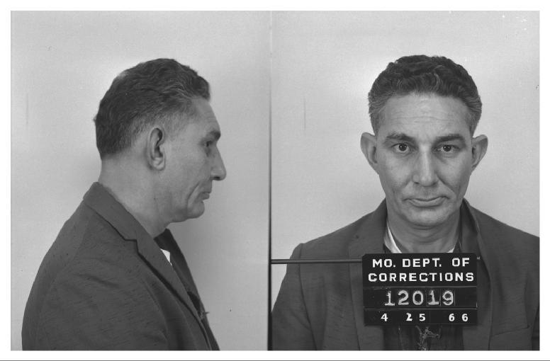
Too much cologne usually means someone is covering up something stinky. Meier, Vegas, Ruby Ridge, Jerry Thomas, Richard McCoy, B. Thomas, Government Employees Ins. Co., Barry the prior owner and manager of the Fountain Bleu, a company out of TX connected to Hurand and Weber, Nichols and the list goes on and on. Knoss might not be so crazy after all!
Quote
Jo, darling. If the "official maps" you refer to are the maps given to Sluggo by the FBI, then you need to take another look at them. They have the airliner going to the PDX VORTAC (which is now the Battleground VORTAC) and then turning to the southwest and passing west of the Portland Airport.
That STATEMENT is exactly what I am referring to. Suddenly someone decides yrs later that the reported route is incorrect and no one was reading the map correctly. Tell me something - the FBI doesn't give out information - so how did Sluggo get this map? And WHY after all these yrs is the map suddenly being interpreted differently?
Wasn't there some discussion of if this map was actually based on what was and what is...NO one here knows exactly what the person who generated the map was referring to. Not unless you are the man who generated the map.
Since the FBI "gave" this map to Sluggo - obviously you are not the one who created the map of the fight path. How can you know which the creator of the map was using - what is or what was. Myths versus Facts....I believe this thread has been invaded by nothing, but myth makers now or those whose only intent is confuse and dispurse.
If the FBI is GIVING out information:
Someone get a picture of the warehouse the car was supposed to be found at and who the car was register to and who the man was that rented it. There is NO way Duane could have known this or shown me this if nothing was every published about it other than just a paragraph in a book. WAS there ever a picture published about this so called place and was the man's name ever dislosed? The organization or the person has a connection to Weber and I will put money on that.
Someone did find a picture of the warehouse or what they thougt was the warehouse - and put it on the thread. I want to see what the FBI has in their file.
If the FBI is NOT going to investigate Cooper - then open the file to the general public.
I am just too tired to continue this - so useless!. I would be better spending my time trying to get back to WA and just go to SEATTLE and stay until someone talks to me. After 15 yrs I deserve someone in the FBI office sitting down with me and actually hearing what I have to say - and to provide me with explanations.
The more I stay at this the more it smells like a cover-up. Everyone is thinking this - and I am not sailing this boat by myself.
Wish I had the money and was well enough to go back to WA right now and stay until I got all of it. If someone can provide me with place to stay for couple of months - I can do the ticket and see if I can rent a piece of junk to drive cheap for 2 months. I have people lined up to do somethings that have never been done, but none of this can be done unless I am there.
I can tell someone something over and over, but sometimes you have to show them. I do know that some of the people I am talking about have been in the area for a long long time and some are retired from this very necessary occupation - all of their time is volunteered if I come after their work lays off...it is seasonal.
There is work to be done in the county records office of several places - this alone will be time consuming...but first the field trip. Once we have that then the county records.
Also remember the answer to WEBER lies in Cour d'alene, but the FBI doesn't want to acknowledge that. Who is connected to who?
I had some long conversations with several people this week. Several people all going in different directions and NOW we are all going in the same direction. COVER-UP.
Too much cologne usually means someone is covering up something stinky. Meier, Vegas, Ruby Ridge, Jerry Thomas, Richard McCoy, B. Thomas, Government Employees Ins. Co., Barry the prior owner and manager of the Fountain Bleu, a company out of TX connected to Hurand and Weber, Nichols and the list goes on and on. Knoss might not be so crazy after all!
Copyright 2006, 2007, 2008, 2009, 2010, 2011, 2012 2013, 2014, 2015 by Jo Weber
Quote1971 PDX VORTAC = 2010 BTG VORTAC
In 1971, "Miles west of PDX" refers to PDX VORTAC or PDX Airport?
ANYONE - Remember this post?
Who decided at that time the map should be read this way or that way. A thread decides what the man who did the map was referring to? Was that the same map done in 1971 or a later version after 1980? The FBI just does NOT give out information like that.
Copyright 2006, 2007, 2008, 2009, 2010, 2011, 2012 2013, 2014, 2015 by Jo Weber
Now I know who is FEEDING the Bird. SUCKER! He claims not to know her address. I thought your statements and question sounded very very familiar. The PDX was NOT just North of her home. I have all of the sitings marked on a very very good map....maybe Galen doesn't know what the address was?
I am a retired Real Estate Sales person and I am still licensed - I can get into files you cannot. Why don't you take the name she used and check the old phone records?????? Or do you just make like a Mocking Bird. Mocking birds become prey to others....a guise or disquise?
Another thing you can do is check the county records for her name - births, deaths, marriage, divorce....this will lead you to more and more. Do your research and then post it.
The Dodo bird (me) did.
How many witnesses did you find that are still alive? I have several, but when the FBI agent came to their door - he did NOT have pen and paper and took no notes (the witnesses felt that was NOT a good thing and considered it strange). When I asked Ralph about this - he said "Some agents do not take notes because it makes the witness feel intimidated". I thought that was the weirdest statement he has made to me in the 15 yrs I have communicated with him.
NO one ever expected me to find actual siting witnesses that are still alive.
Note to Robert 99
There were sitings of that plane below 10K. I live between several bases - and I have been shown by pilots - just how high the planes are that pass over. North and East of the Lewis - the plane did drop in altitude and continued to do so until they approached East of the PDX swinging over toward Cames - they were trying to stay out of populated areas and they had to be clear of the PDX air traffic. ,,which took them right over Troudale Industrial and the airstrip there. (Don't forget the sitings in that area). Maybe it was other aircraft going in and out of PDX...but the 727 had to say above then and out of the way.
The siting in the Heisson area definitely were low - 5K to 6K. The clouds where there, but the plane sounded like a plane in trouble it was so low. - thru the layers of clouds they they could see lights above. I told the man the plane was probably higher because the layered cloud coverage - might give one the allusion of the plane being lower.
He wouldn't bite on that and said swore it was NOT over 5K (sound and lights) - this is North East of Battleground.
Sitings in Hiesson also claim the plane was lower. The sound was NOT that of the chase planes like Himmelsbach tried to tell one of the witnesses - she knew the sound of the small fast crafts versus a 727. I know the difference in the sound coming thru my area. 5 bases and 2 airports not counting all of the small private strips.
Share this post
Link to post
Share on other sites