mr_prick 0 #1 June 20, 2007 ok, so i got me one... now how do i mount it? how did you guys mount your gps? and where? helmet or rig? any hints/help would be appreciated. preferably with drawings or photos...i'm not so smart. i was thinking about just glueing a pocket on top of the helmet with some industrial adhesive. helmet is a rat hat. thanks in advance! Quote Share this post Link to post Share on other sites
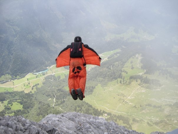
LouDiamond 1 #2 June 20, 2007 You can mount it several different ways depending on your preferences. If you have a helmet with exsisting protrac/dytter pockets mounted on the outside of the helmet,those work fine as the 201 is roughly the same size. You can also mount a Neptune bracket to your helmet, like Vidiot has done in the attached pictures easily. I have used it sucessfully inside my helmets Neptune pocket on several occassions if you prefer something more secure. The 201 gets pretty good reception but its always best to mount any GPS receiver so that it has a clear view of the sky if possible."It's just skydiving..additional drama is not required" Some people dream about flying, I live my dream SKYMONKEY PUBLISHING Quote Share this post Link to post Share on other sites
bdrake529 0 #3 June 20, 2007 Where can I buy a "Neptune bracket" like shown in the pics?Brian Drake Quote Share this post Link to post Share on other sites
LouDiamond 1 #4 June 20, 2007 QuoteWhere can I buy a "Neptune bracket" like shown in the pics? Quickest and easiest way is here"It's just skydiving..additional drama is not required" Some people dream about flying, I live my dream SKYMONKEY PUBLISHING Quote Share this post Link to post Share on other sites
KrisFlyZ 0 #5 June 20, 2007 Anyone in Europe/UK buy one? Where? The only place I can find one is http://www.gps4less.co.uk/ and it says WBT 201 but does not say wintec. Kris. Quote Share this post Link to post Share on other sites
jakee 1,260 #6 June 20, 2007 There is just something I find seriously wrong about mounting very small, very expensive pieces of kit on the outside of helmets. That may change as I become more financially secure, but as of now it gives me the heeby jeebys. Do you want to have an ideagasm? Quote Share this post Link to post Share on other sites
phoenixlpr 0 #7 June 21, 2007 Quote There is just something I find seriously wrong about mounting very small, very expensive pieces of kit on the outside of helmets. That may change as I become more financially secure, but as of now it gives me the heeby jeebys. Look at [ url "http://spidernest.ath.cx/gallery/p81/20060707030_G"]this[/url]. What is wrong with that? Or you can slide it into your ROL pouch and put something over it as a plug like a piece of sock or something similar. Quote Share this post Link to post Share on other sites
mr_prick 0 #8 June 21, 2007 that looks easy and clean! thanks a lot! i already have a neptune bracket. i'll use that and maybe add 2 tie wraps. unfortunately first flight won't be this weekend. thanks all! n Quote Share this post Link to post Share on other sites
mr_prick 0 #9 June 21, 2007 i bought it on ebay germany for 99 euro. Quote Share this post Link to post Share on other sites
mr_prick 0 #10 June 21, 2007 i thought about something like this first, just on the rig. like the official pro tracks for speed skydiving. does the fabric obstruct the reception of the unit? probably not, eh? Quote Share this post Link to post Share on other sites
phoenixlpr 0 #11 June 21, 2007 Quote does the fabric obstruct the reception of the unit? probably not, eh? Is this and that enough evidence for you? Quote Share this post Link to post Share on other sites
mr_prick 0 #12 July 17, 2007 ok. installed it and it works. screwed my first 7 flights up by having paralog delete the memory and didn't save it in paralog. oh well. now i just took it up for a base jump, 126 meters, 3 sec delay. paralog doesent record anything obviously, and the track i put into google earth via time machine x looks weird. exit altitude is right but then it doesent really resemble my jump and stops logging at 68 meters. that is in 3d. in 2d flight path looks ok but still starts at 126 and ends at 68.it ends exactly where i turned it off though. any ideas? Quote Share this post Link to post Share on other sites
IslandGuy 0 #13 July 17, 2007 Quoteok. installed it and it works. screwed my first 7 flights up by having paralog delete the memory and didn't save it in paralog. oh well. now i just took it up for a base jump, 126 meters, 3 sec delay. paralog doesent record anything obviously, and the track i put into google earth via time machine x looks weird. exit altitude is right but then it doesent really resemble my jump and stops logging at 68 meters. that is in 3d. in 2d flight path looks ok but still starts at 126 and ends at 68.it ends exactly where i turned it off though. any ideas? I am no expert but here are some thoughts. Are you using the latest version of Time Machine (TM)? They just released a greatly improved rev around end of June and an even newer rev just yesterday. http://www.wintec.com.tw/en/support_detail.php?cate_id=11&support_id=65 Open up TM and click the HELP button (upper right). You can use most of the settings as explained there. Under GPS Setting/SBAS, I check "Enable", "Apply Integrity Information", "Apply SBAS...", and "Ranging...". Also, "1 Channel", and "WAAS". (Click "Set" when done.) Under GPS Setting/Navigation Setting, I select "7 - Airborne under 4g", and, "3 - 3D only". I do not check "Allow Almanac Navigation", but do Enable RAIM. (Click "Set" when done.) Under Log Setting, Select "Time" button and set Cond 1 for 0 to 2000KMH. and Cond 2 to 1 sec. (Click "Set" when done.) Under Device Setting/Track Point be Marked..., I set that to 0. Note: I haven't installed yesterday's release of TM so some of the above may be wrong. The Google Earth plots I've been getting look good. Hope this helps. MikePlay like your life depends on it. Quote Share this post Link to post Share on other sites